Initial attempt to geocode fire address data#9
Draft
vpipkt wants to merge 2 commits into
Draft
Conversation
Author
|
There is a master address list on the City open data portal that has coordinates. This may have a good first bet for address matching. |
Author
|
Other thoughts:
|
Author
|
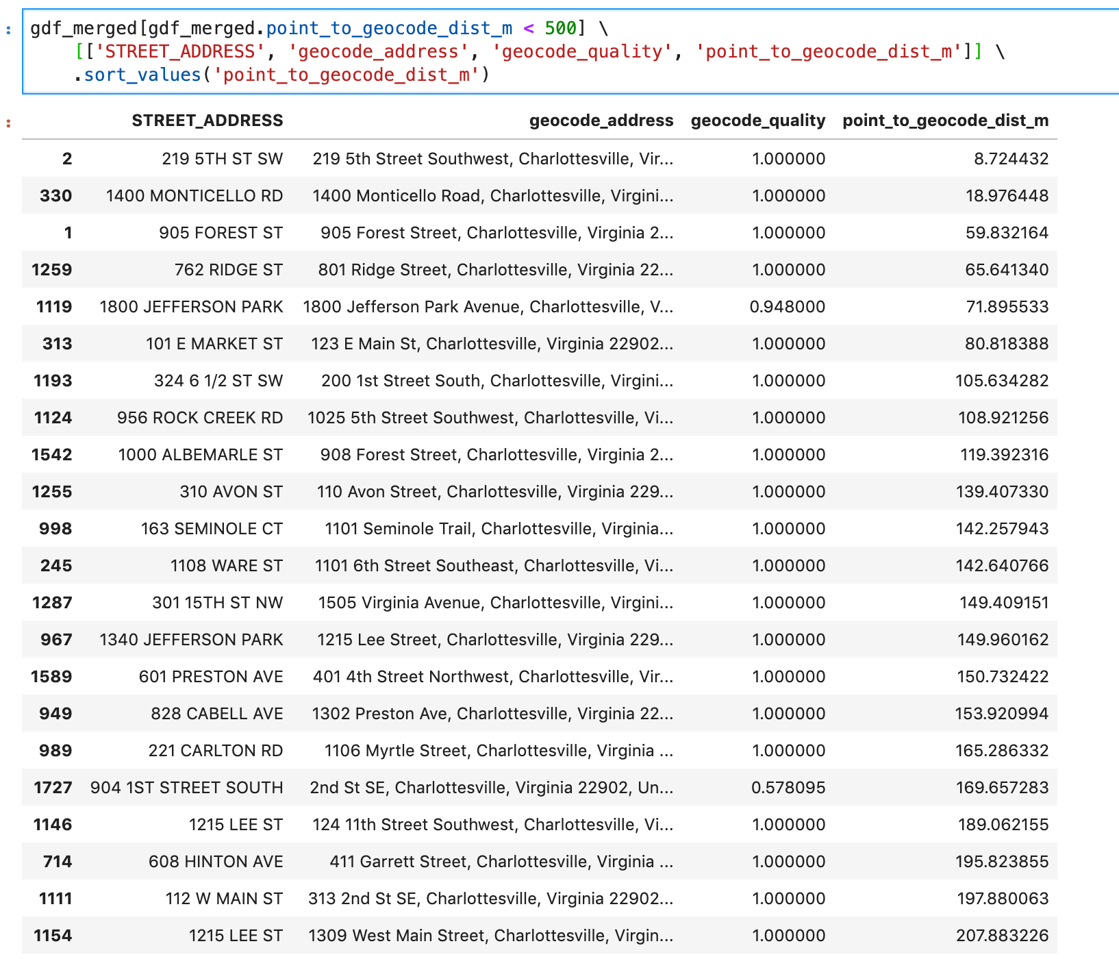
These are the "best" matches in terms of distance
|
Author
Doug Caldwell gives us the specifics: https://codeforcville.slack.com/archives/C011UU9654N/p1588373135001300 This is EPSG:2284. https://spatialreference.org/ref/epsg/nad83-virginia-south-ftus/ https://trello.com/c/LikXTlwm/12-projection-used-by-city-of-charlottesville |
This file contains hidden or bidirectional Unicode text that may be interpreted or compiled differently than what appears below. To review, open the file in an editor that reveals hidden Unicode characters.
Learn more about bidirectional Unicode characters
Sign up for free
to join this conversation on GitHub.
Already have an account?
Sign in to comment
1 participant
Add this suggestion to a batch that can be applied as a single commit.This suggestion is invalid because no changes were made to the code.Suggestions cannot be applied while the pull request is closed.Suggestions cannot be applied while viewing a subset of changes.Only one suggestion per line can be applied in a batch.Add this suggestion to a batch that can be applied as a single commit.Applying suggestions on deleted lines is not supported.You must change the existing code in this line in order to create a valid suggestion.Outdated suggestions cannot be applied.This suggestion has been applied or marked resolved.Suggestions cannot be applied from pending reviews.Suggestions cannot be applied on multi-line comments.Suggestions cannot be applied while the pull request is queued to merge.Suggestion cannot be applied right now. Please check back later.
Currently a work in progress. Most of the locations we are getting by geocoding addresses are several kilometers away from the stated coordinate.
So far I have used Mapbox thru the python
geocoderpackage. Because it is free to get an API key and I think it's free to do some small number of requests.